Categories > Guides and Tips
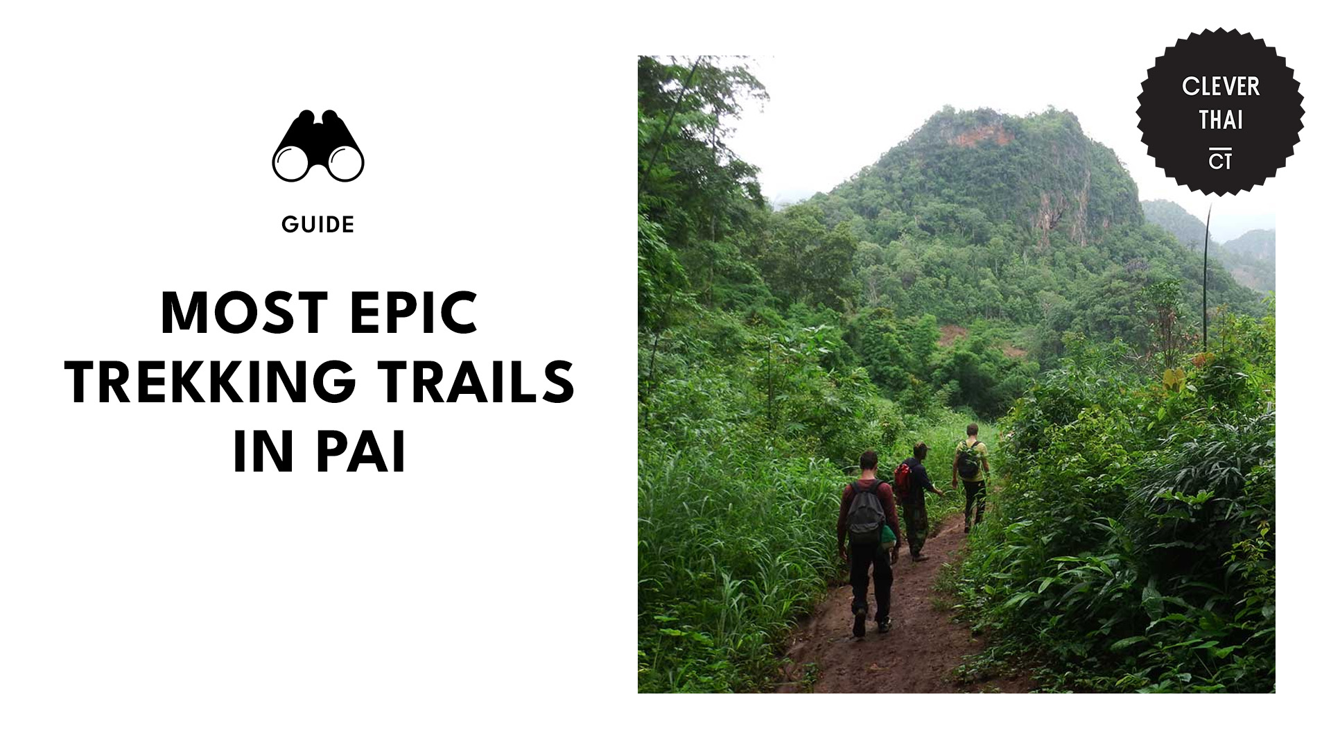
Top 10 Unforgettable Trekking Trails in Pai That Are Worth Every Huff and Puff

Every friend group has that one person who randomly suggests the most exhausting and physically demanding activities. Well, it looks like I’m that friend. I’m always dragging my friends along on trekking trails that involve slipping on rocks and crossing rivers.
But how could we let them miss out on jaw-dropping views, right? Sure, there’s some huffing and puffing—especially when the path gets steeper or disappears into a tangle of roots—but by the time we reach the viewpoint or waterfall at the end, all complaints magically vanish.
Pai’s packed with incredible trails, from lush valleys to dramatic canyons. So, if you’re up for an adventure, below are our top picks for the best trekking trails in Pai.
Mae Yen Waterfall Trek
Media from nolohub
Address: 9F66+MJW, Unnamed Road, Mae Hi, Pai District (starting point)
Distance: 12–14 km (round trip)
Duration: 4–6 hours
Difficulty: Moderate
Website
The Mae Yen Waterfall Trek is a solid day trek for anyone wanting to swap Pai’s laid-back vibes for muddy boots and river splashes. The trail kicks off near town, cutting through banana groves and thick jungle, with the river as your constant companion.
Expect to cross the water over 30 times—some spots hit knee-deep, so roll up those pants. The path isn’t groomed, so you’ll climb over roots and rocks, especially on the final uphill push to the waterfall.
When you arrive, the three-tiered cascade is a chill spot to unpack lunch, though the pools are shallow, so don’t expect deep swims. And there’s no hand-holding—just you, the jungle, and maybe a few bugs.
Pro tip:
Waterproof sandals with grip are a must—the rocks are slick even when dry. Aim to start at 8 AM to dodge the heat and potential afternoon downpours that turn the trail into a mudslide.
Hua Chang Waterfall Trek
Media from lilpowaa
Address: CG68+5H, Wiang Nuea, Pai District
Distance: 14 km (round trip)
Duration: 4–5 hours
Difficulty: Moderate
Website
The Hua Chang Waterfall Trek is a no-frills jungle adventure for those who prefer trails less traveled. Starting about 7 km northeast of Pai, this trek throws you straight into the wild with over 20 river crossings, and a muddy, unmarked path that keeps things interesting.
The trail follows the Mueng Luang River, passing small farms and the occasional water buffalo crew before narrowing into wilder terrain. It’s not exactly signposted, so keep an eye out for faded ribbons tied to branches—they’re your lifeline when the trail vanishes into the river.
The payoff? A roaring three-tiered waterfall that feels refreshingly off-the-radar. The scramble up the last stretch is a bit dicey (slippery rocks, loose dirt), but the view of water crashing into a misty pool is pure northern Thailand magic.
Pro tip:
Swimming isn’t recommended here—the plunge pool’s strong currents and remote location make it risky—but the view alone is worth the trek.
Pai Canyon
Media from lily_wenchen
Address: 8F43+F22, Mae Hi, Pai District
Distance: 3–5 km (loop)
Duration: 1–3 hours
Difficulty: Moderate
Website
Pai Canyon is just 8 km south of Pai town, this rocky maze of narrow ridges and steep drops offers 360-degree views of the surrounding valleys and mountains.
The trail starts with a steep climb up the stairs to a viewpoint, then splits into paths so skinny you’ll feel like a tightrope walker—some sections are barely a foot wide, with 30-meter drops on either side.
While the main route is doable for most, the real challenge comes with scrambling down rocky sections using hands and feet to reach deeper parts of the canyon. Just don’t underestimate the terrain: dusty paths, loose rocks, and zero shade; this hike rewards preparation.
Pro tip:
Wear closed-toe shoes with serious grip (hiking sneakers or trail runners) and skip bulky backpacks—they’ll throw off your balance on narrow ridges. Check the weather: even a light rain turns the sandstone into a slip hazard.
Bamboo Bridge Loop
Media from elamanihelminauha
Address: 89FV+273, Unnamed Road, Thung Yao, Pai District
Distance: 1.5–2 km (loop)
Duration: 1–2 hours
Difficulty: Easy to moderate
Website
The Bamboo Bridge Loop isn’t your typical jungle trek—it’s a peaceful, culture-filled walk. Villagers constructed it in 2016 as a bridge from Ban Pabok village to the Wat Pa Huau Khai Khiri monastery, and it’s an 800-meter-long bamboo path that weaves through rice fields.
You’ll begin at a small entrance gate (around ฿30 entry fee) and follow the springy bamboo path, reinforced with steel and concrete underneath for stability. It’s flat and family-friendly, but watch for uneven slats or wobbly sections.
Halfway through, you’ll pass a fish pond and rustic rest huts, perfect for snapping photos of the landscape. The loop ends at the forest temple, where a golden Buddha statue and quiet forest trails invite reflection.
Pro tip:
Avoid March to May—smoker from the field burning reaches the area, and many nearby guesthouses close.
Pam Bok Waterfall Trek
Media from taylorhickson.jpg
Address: Unnamed Rd Tambon Thung Yao Amphoe Pai Chang Wat
Distance: 1 km (round trip)
Duration: 1–2 hours
Difficulty: Easy to moderate
Website
The Pam Bok Waterfall is a 20-minute scooter ride from Pai, the trail starts at a parking lot where you’ll pay the ฿200 entrance fee (now mandatory) before a short walk down a mix of stairs, rocky paths, and a bamboo bridge to the falls.
The waterfall itself sits in a mossy canyon, with a modest cascade flowing into a deep pool—perfect for a swim if you’re visiting around July to November (rainy season). Dry-season travelers might find it more of a trickle, though.
What makes Pam Bok stand out is its hidden “back trail,” a steep dirt path to the right of the main waterfall that leads to quieter pools and a secluded stretch of river. The scramble-up isn’t for everyone, but it’s worth it if you want to dodge the occasional tour group.
Pro tip:
Skip March to May since there might be smoke from agricultural burning which ruins the views.
Doi Kiew Lom Viewpoint
Media from ron1986
Address: C8W9+8M7, Tham Lot
Distance: 1 km (round trip)
Duration: 30 mins–1 hour
Difficulty: Easy
Website
Doi Kiew Lom Viewpoint isn’t just a photo stop—it’s a gateway to quick trails with big rewards. While most visitors snap pics from the roadside lookouts, the real gems lie on the trails branching into the Lum Nam Pai Wildlife Sanctuary.
Grab a free permit from the checkpoint (required for hiking beyond the viewpoints), and you’ll climb through pine forests and rocky outcrops to quieter ridges.
The main path is a 1 km loop with mild elevation gain, but adventurous hikers can extend it to 3 km by linking up with less-crowded dirt trails marked by faded ribbons.
Pro tip:
If you’re on a scooter, take the steep, winding road slow—locals know the curves can bite.
Santichon Village to Yun Lai Viewpoint
Media from led_dot
Address: 999W+J56, Wiang Tai, Pai District
Distance: 3–4 km (round trip)
Duration: 1–2 hours
Difficulty: Easy to moderate
Website
This short but experienced-packed trek blends a walk through Pai’s Yunnanese culture with a climb to one of the region’s best viewpoints. It kicks off at Santichon Village, where you’ll pass by traditional clay houses, tea stalls, and souvenir shops.
From the village, the path to Yun Lai Viewpoint gets steep and rocky, climbing through farmland and pine forests. The final 1 km ascent is the trickiest, with uneven terrain and gravel, but rewards you with views of Pai’s valleys and the famous “sea of mist” that blankets the area.
At the top, there’s a small entry fee (about ฿20), which gets you access to viewing platforms, a Chinese-style tea house, and plenty of photo ops—think heart-shaped signs and misty mountain backdrops.
Pro tip:
Mornings are prime time: arrive by 6 AM to catch the sunrise or lingering mist.
Tham Lod Cave Trek
Media from lauradi0nne
Address: 107 หมู่1 Tham Lot
Distance: 1.6 km (cave exploration) + 2 km jungle trails
Duration: 2–3 hours (cave and trails)
Difficulty: Moderate
Website
The Tham Lod Cave Trek is located 50 km north of Pai, it starts with a drive to the cave entrance, but the real trekking kicks off once you’re inside.
A local guide and bamboo raft are non-negotiable—you’ll paddle through a dim river tunnel before hopping off to navigate steep staircases and narrow limestone passages.
Heads up: the terrain’s slippery, dark, and a bit claustrophobic in places, with jagged rocks and low ceilings. Outside the cave, a short jungle trail loops through the forest, passing smaller caves and leading to Pang Mapha Cliff, where ancient coffins rest on ledges high above the ground.
Pro tip:
Book a guide through your accommodation—some speak basic English and explain the history better than on-site hires. Skip loose clothing to prevent snags in narrow passages.
Mo Paeng Waterfall Trail
Media from peet_p_k
Address: 99HG+G8M, Mae Na Toeng
Distance: 1–2 km (round trip)
Duration: 1–2 hours
Difficulty: Easy
Website
The Mo Paeng Waterfall Trail is 10 km from Pai town, it starts with a short steep 15-minute climb through a rocky forest path—grippy shoes are key here, as loose gravel and tree roots keep you on your toes.
The reward? A series of smooth limestone terraces and natural water slides. But you have to know that this place gets packed with locals and travelers on weekends.
The upper tiers are quieter, but reaching them requires scrambling over slippery rocks (no handrails here).
Pro tip:
Visit on weekday mornings to dodge crowds, and skip the rainy season when flash floods make the current unsafe.
Mae Hong Son Loop Section (Pai to Pang Mapha)
Media from le_baroudeur_empathique
Address: 7XM6+445, 128, Chong Kham
Distance: 1.6–8 km (depending on trail)
Duration: 2–8 hours
Difficulty: Moderate
Website
The Pai to Pang Mapha stretch of the Mae Hong Son Loop is a little bit of everything northern Thailand has to offer—jungle treks, cave explorations, and visits to remote villages.
Kick things off with the Tham Lod Cave trek (as mentioned above), a guided crawl through pitch-black caverns where bamboo rafts and kerosene lanterns lead you over slick rocks and past ancient burial sites.
For a tougher challenge, the Pang Mapha Backcountry Loop (5-8 km) throws unmarked jungle paths, river crossings, and steep climbs past Lahu villages and hidden caves. Shorter options include the Sai Ngam Hot Springs Forest Walk (1 km)—a quick view of the natural thermal pods.
Pro tip:
Hire a Pang Mapha-based guide (฿500– ฿800) for the Backcountry Loop—they’ll navigate dead ends and translate chats with villagers.